Arabian Sea borders the western coast of India. It acquired its name from the Arab merchants who engaged in maritime trade with India. There have been extensive trade and cultural links between India and the Arab world stretching across several centuries. The sea is a part of the Indian Ocean. Arabian Sea mingles with the waters of Bay of Bengal off the coast of Dhanushkodi. The Queen of Arabian Sea is Kochi which is the hub for spice trade world-wide.
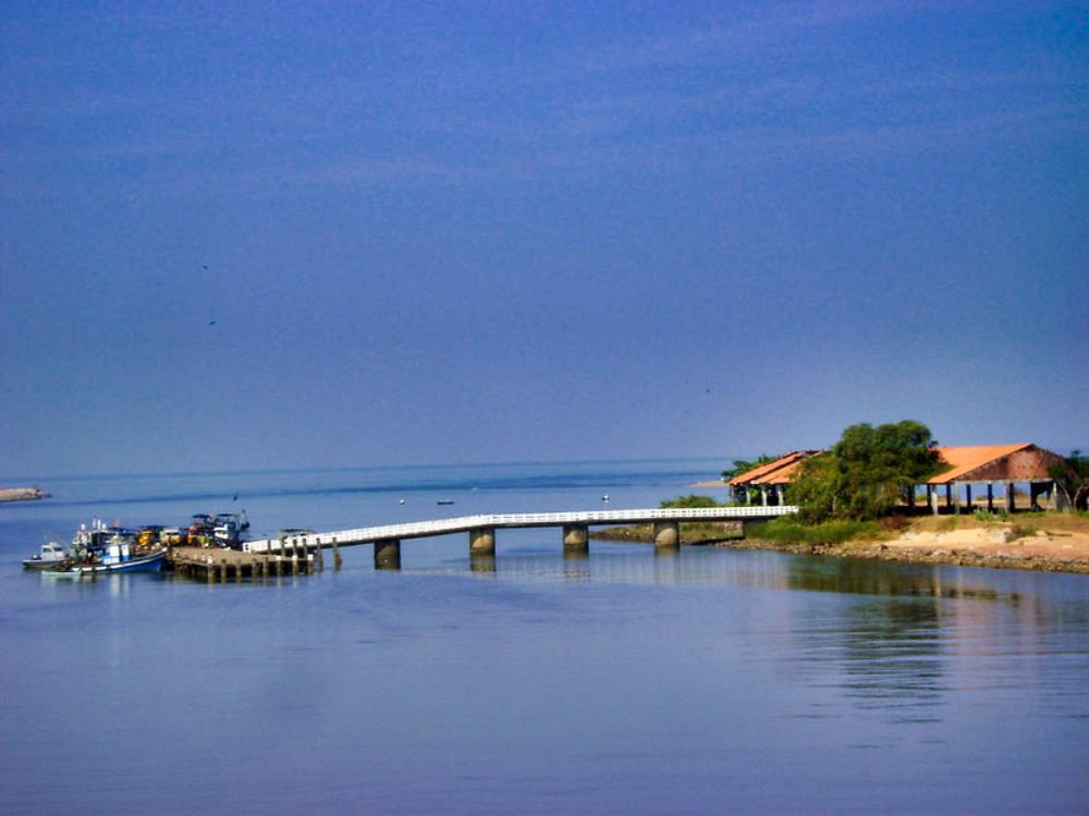
Kadappuram Fishing Harbour
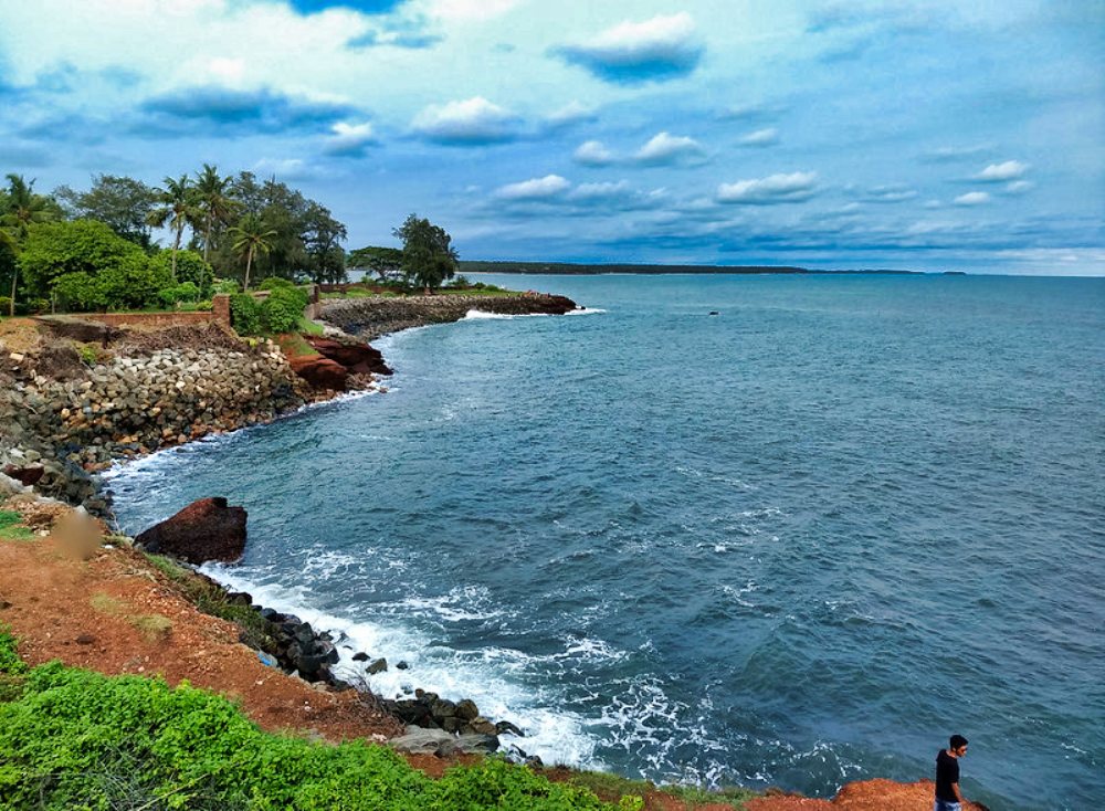
The picture above shows Kadappuram Fishing Harbour in Kasaragod. I shot the photo from a moving train. You get good views of Chandragiri Puzha and the sea from here. Chandragiri Fort and Malik Deenar Juma Masjid are nearby. Malik Deenar Juma Masjid is one of the oldest mosques in India.
Kalamb Beach
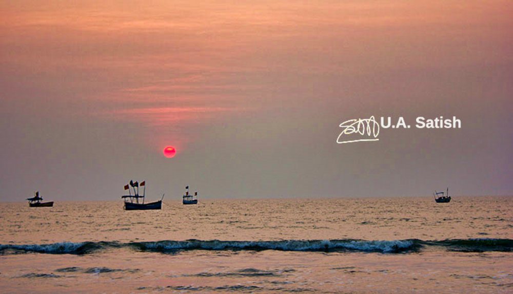
Kalamb beach is a secluded and big beach near Nala Sopara. It is one of the cleanest beaches in Mumbai. The sands are dark in colour, may be because of the presence of minerals. Rajodi Beach is 4.5 km to the north. Cars and bikes freely enter Kalamb beach. The sea comes in at high tide and the wet sand makes the beach easy to ride on. Beautiful sunsets are a big attraction.
Alappuzha Beach and Ruined Pier
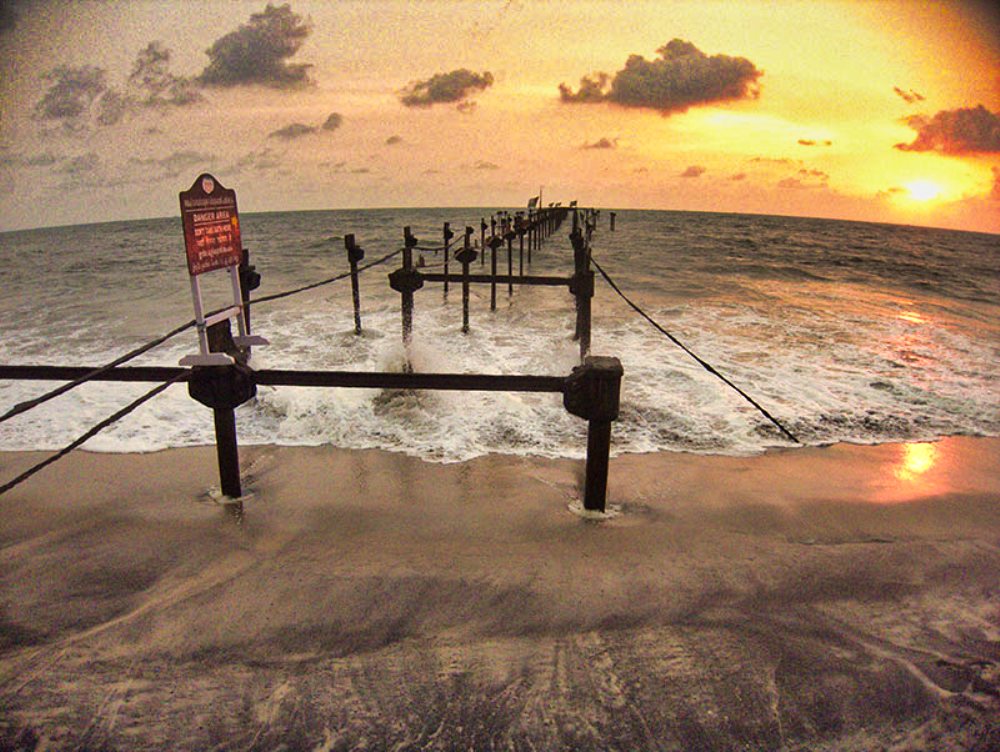
The old pier in Alappuzha beach has fallen apart after the port discontinued operations. You can still see skeletal remains of the pier. The beach itself was crowded when we went on a Sunday evening. Construction work has been going on for an elevated road by the beach. The beach itself is wide and has white sands. Light beams from the lighthouse skip through the beach at night.
Mumbai Harbour
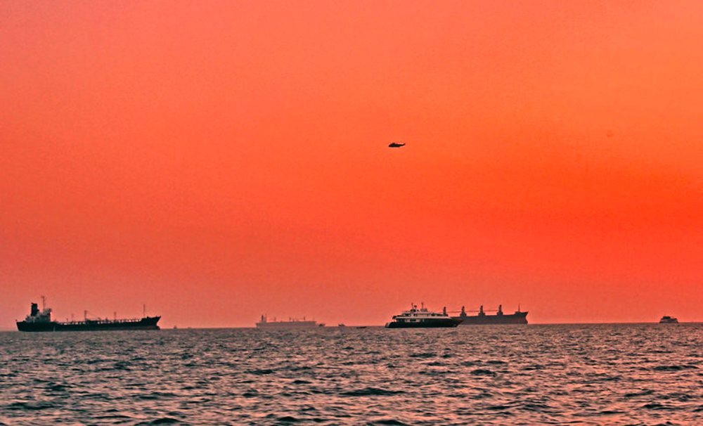
We went on a short boat ride of 60 minutes from Gateway of India. The ride takes you round the harbour. We noticed many naval and commercial ships. There was also a naval chopper flying above us. Waters of the Arabian Sea were calm.
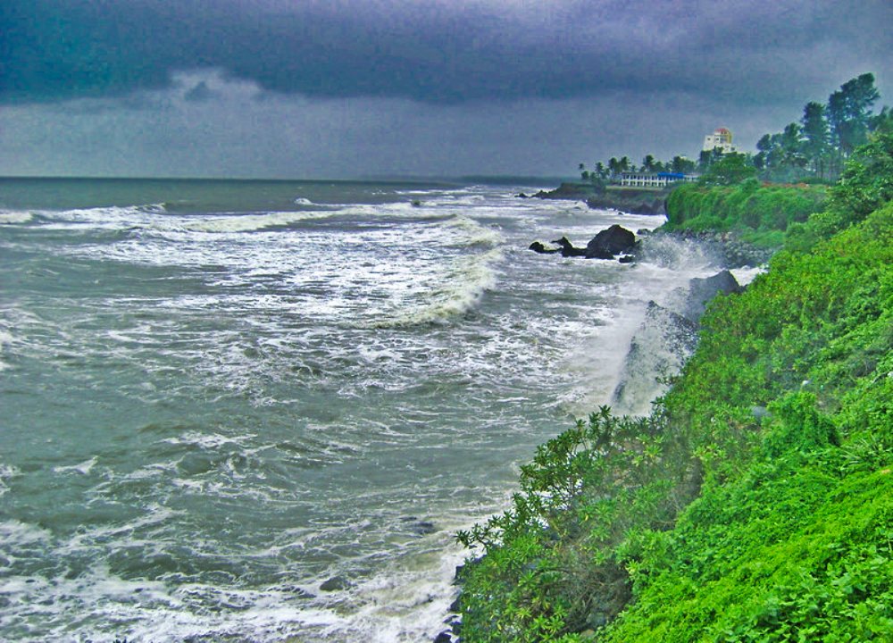
Arabian Sea Opposite Kannur Lighthouse
Sea View Park and Government Guest House stand opposite the lighthouse in Kannur. The structures are on a cliff. Dow below is the sea. During the monsoon period, the sea tends to be rough. Protective railings keep visitors safe.
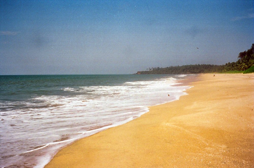
The Beach at Neerkkadavu in Kannur
Neerkkadavu is a village, 7.1 km from Kannur railway station. The beach has golden sands. Few tourists visit the place. A road runs parallel to the sea to Payyambalam beach (4.1 km, 50 min by walk). Azhikkal lighthouse is to the north, 7.5 km.
Bandra Sea Link
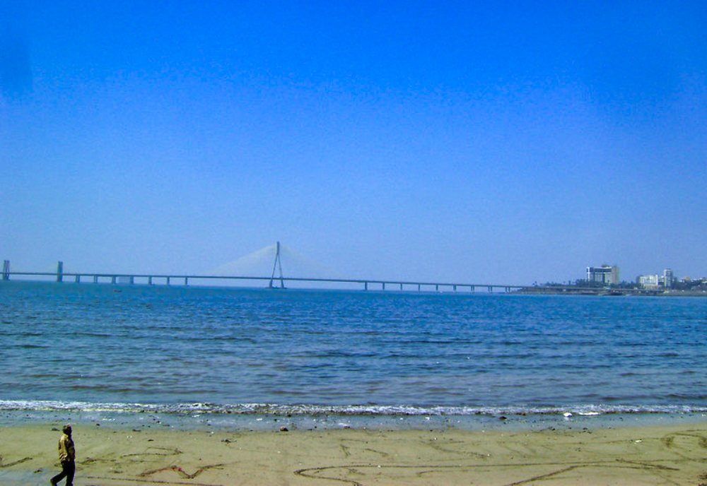
The sea bridge connects Bandra and Worli. It is 5.6 km long. The bridge bypasses Mahim Causeway and cuts travel time between Bandra and South Mumbai. About 37,000 vehicles drive over the bridge every day. The bridge employs cable stays in its construction.
Kovalam Beach
From the city centre of Trivandrum, Kovalam is 17 km. There are three beaches in Kovalam along a 17 km stretch. These are Samudra, Lighthouse and Hawa beaches. The most famous of them is Lighthouse beach. It is crescent shaped and has an old lighthouse on a hillock at the southern end. The sea is safe for swimming if you do not venture too far out.
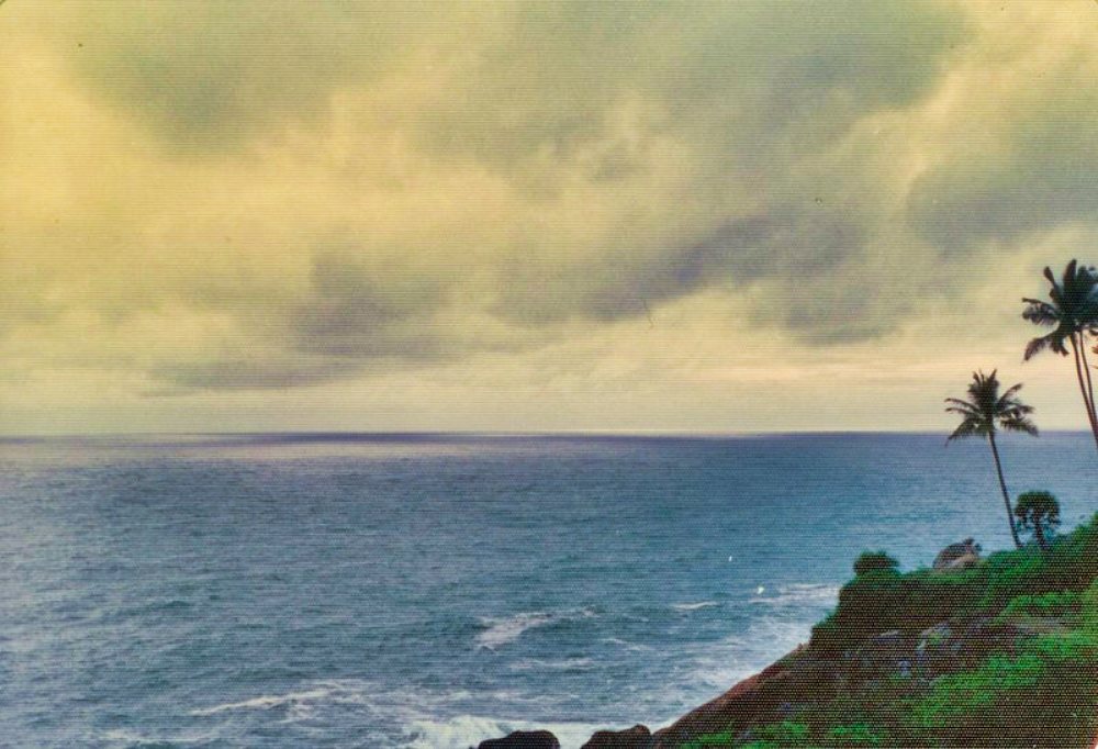
Sea Off Saint Angelo Fort
Saint Angelo Fort in Kannur stands on a cliff by the side off Mapilah Bay. It has a history going back to more than 500 years. The waves of Arabian Sea break against one side of the fort. It is also known as Kannur Fort.
If you liked the post, you could…
Join more than 5,000 fans of UASATISH by liking us on Facebook, or follow us on Twitter and Instagram.
You may also like to see:
- Alappuzha home to beaches backwaters and canals
- Kannur Lighthouse and Sea View Park
- Saint Angelo Fort surprisingly staggering history